


 Kentsel Elektrikli Ulaşım
Maps
Coast Tram
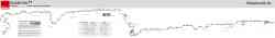 |
Source: www.gleisplanweb.eu Ağustos 2023 Yıl |
 |
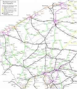
Схема маршрута из официального буклета. 2 закрытые в данный момент остановки в схеме отсутствуют. В схеме отмечен транспорт, на который можно пересесть на указанных остановках. 25 Eylül 2011 Yıl |
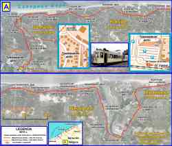 |
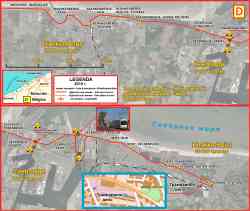
Береговой трамвай — самый длинный трамвайный маршрут в мире. 68 километров. 19 Kasım 2010 Yıl |
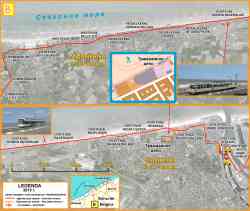 |
Береговой трамвай — самый длинный трамвайный маршрут в мире. 68 километров. 18 Kasım 2010 Yıl |
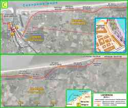 |
Береговой трамвай — самый длинный трамвайный маршрут в мире. 68 километров. 17 Kasım 2010 Yıl |
 |
Береговой трамвай — самый длинный трамвайный маршрут в мире. 68 километров. 15 Kasım 2010 Yıl |
 |
Image used under 'Fair Use' conditions. 2007 Yıl |
 |
Coast Tram 1991 Yıl |
Karanlık Tema
Bu sitedeki herhangi bir görüntüyü sahibinin izni olmadan kullanmak yasaktır..