


 Kentsel Elektrikli Ulaşım
Maps and Plans
Boston
 |
Nisan 2013 Yıl |
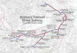 |
Схема первой подземки США с датами открытия. Public Domain. Источник: http://en.wikipedia.org/wiki/File:Tremont_Street_Subway.jpg 2005 Yıl |
 |
1965 Yıl |
 |
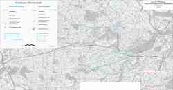
Eastern Massachusetts 1913 Yıl |
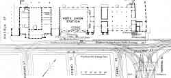 |
Plan of Causeway Street Station adjacent to the North Union Station 1913 Yıl |
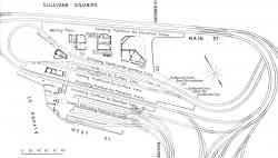 |
Plan of track layout at Sullivan Square Station 1913 Yıl |
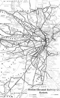 |
Map of the Boston Elevated Railway Co. system 1908 Yıl |
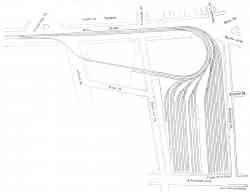 |
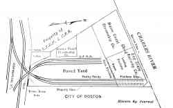
New Sullivan Square elevated storage yard of the Boston Elevated Railway Kasım 1907 Yıl |
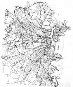 |
Map of the Boston, showing lines of the West End Street Railway Co. 1895 Yıl |
Karanlık Tema
Bu sitedeki herhangi bir görüntüyü sahibinin izni olmadan kullanmak yasaktır..