


 Kentsel Elektrikli Ulaşım
Maps
Munich
 |
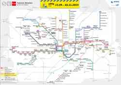
Alternative Map of Munich Underground and Suburban Trains (Sark Version) 15 Aralık 2024 Yıl |
 |
Alternative Map of Munich Underground and Suburban Trains 15 Aralık 2024 Yıl |
 |
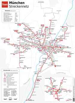
Liniennetzplan Straßenbahn München, gültig 2024 • Схема трамвайной сети Мюнхена, действует в 2024 году • Scheme of tramway network in München, valid in 2024 2024 Yıl |
 |
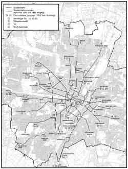
Tramnetz München 21 Eylül 2019 Yıl |
 |
License CC-BY-SA 2.0 Aralık 2018 Yıl |
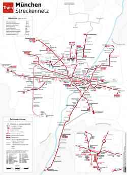 |
Схема трамвайного сообщения / Schema Straßenbahnlinien 2014 Yıl |
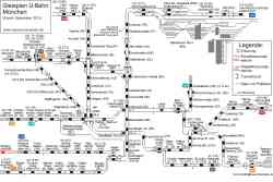 |
Схема путевого развития Мюнхенского метрополитена Aralık 2010 Yıl |
 |
U-Bahn — Miscellaneous photos Schema der Integration des Transrapids in den Münchner Hauptbahnhof • Схема интеграции Трансрапида в центральный вокзал Мюнхена • Diagram of the integration of the Transrapid system into Munich Central Station 2008 Yıl |
 |
Transrapid project Munich Central Station — Airport (2000 — 2008) Geplante Streckenführung des Transrapid • Планируемый маршрут Трансрапида • Planned route of the Transrapid 2000 Yıl |
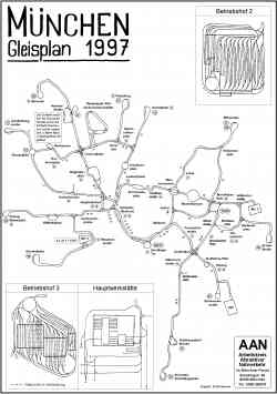 |
License CC-BY-SA 2.0 1997 Yıl |
 |
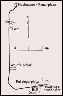
License CC-BY-SA 2.0 1964 Yıl |
 |
Map of the Munich trolleybus network, consisting of the solo Line 032 (later 58). 25 Ekim 1959 Yıl |
 |
License CC-BY-SA 2.0 1914 Yıl |
Karanlık Tema
Bu sitedeki herhangi bir görüntüyü sahibinin izni olmadan kullanmak yasaktır..