


 Transports Électriques de Ville
Maps and Plans
Minneapolis–St. Paul
 |
Author: Senori 25 juin 2014 |
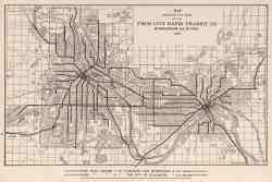 |
Map Showing the Lines of the Twin City Rapid Transit Co., Minneapolis and St. Paul, 1913 1913 |
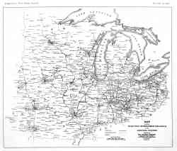 |
Chicago — Maps and Plans Chicago 1906 |
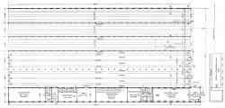 |
Plan of Snelling Avenue Car House 1904 |
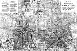 |
Map of Minneapolis, St. Paul and vicinity 1894 |
Thème foncé
L'utilisation d'images de ce site web sans l'autorisation des auteurs est strictement interdite.