


 Elektrinis miestų viešasis transportas
Maps and Plans
Minneapolis–St. Paul
 |
Author: Senori 2014 m. birželio 25 d. |
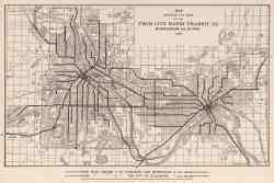 |
Map Showing the Lines of the Twin City Rapid Transit Co., Minneapolis and St. Paul, 1913 1913 m. |
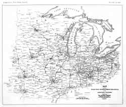 |
Čikaga — Maps and Plans Čikaga 1906 m. |
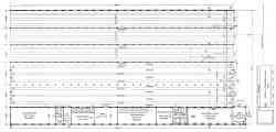 |
Plan of Snelling Avenue Car House 1904 m. |
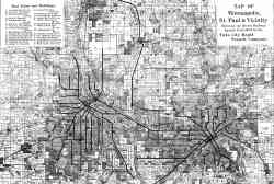 |
Map of Minneapolis, St. Paul and vicinity 1894 m. |
Tamsi tema
Nuotraukų ir kito publikuojamo tinklapyje turinio naudojimas galimas tik gavus turinio autorių sutikimą.