Transphoto
Fotos werden ohne nachträgliche Veränderungen veröffentlicht und dienen nicht zur Verbreitung politischer Ansichten oder Positionen.

Alle Fotos werden durch Nutzer zur Verfügung gestellt und stellen keine Meinung der Redaktion dar.

Schließen
New Albany — Maps; Fort Wayne — Maps; Evansville — Maps; South Bend — Maps; Hammond — Maps; Gary — Maps; Interstate Public Service — Maps; Indianapolis — Maps and Plans; Terre Haute — Maps and Plans; Union Traction of Indiana — Maps and Plans; Jeffersonville — Maps and Plans; Michigan City — Maps and Plans
  New AlbanyMaps
  Fort WayneMaps
  EvansvilleMaps
  South BendMaps
  HammondMaps
  GaryMaps
  Interstate Public ServiceMaps
  IndianapolisMaps and Plans
  Terre HauteMaps and Plans
  Union Traction of IndianaMaps and Plans
  JeffersonvilleMaps and Plans
  Michigan CityMaps and Plans
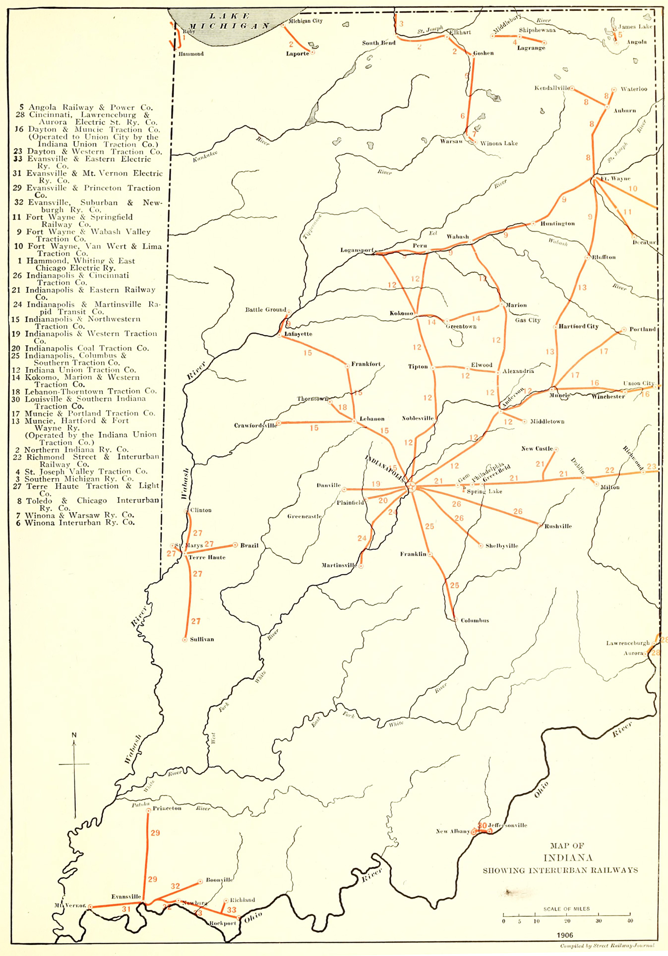
Map of Indiana, showing interurban railways

Street Railway Journal, volume 28, number 15 (10/13/1906), plate XIX

Hochgeladen von AlexSan · Odesa           Datum: . 1906

Statistik

Lizenz: Public domain
Veröffentlicht: 07.12.2020 00:47 MSK
Aufrufe — 491

Detailinformation

Bewertungen

Kommentar

Bitte keine politischen Diskussionen, andernfalls wird Ihr Account für einen Monat gesperrt!
Zu Kommentieren ist eine Anmeldung nötig..