Transphoto
Fotos werden ohne nachträgliche Veränderungen veröffentlicht und dienen nicht zur Verbreitung politischer Ansichten oder Positionen.

Alle Fotos werden durch Nutzer zur Verfügung gestellt und stellen keine Meinung der Redaktion dar.

Schließen
Bergen — Maps
  BergenMaps
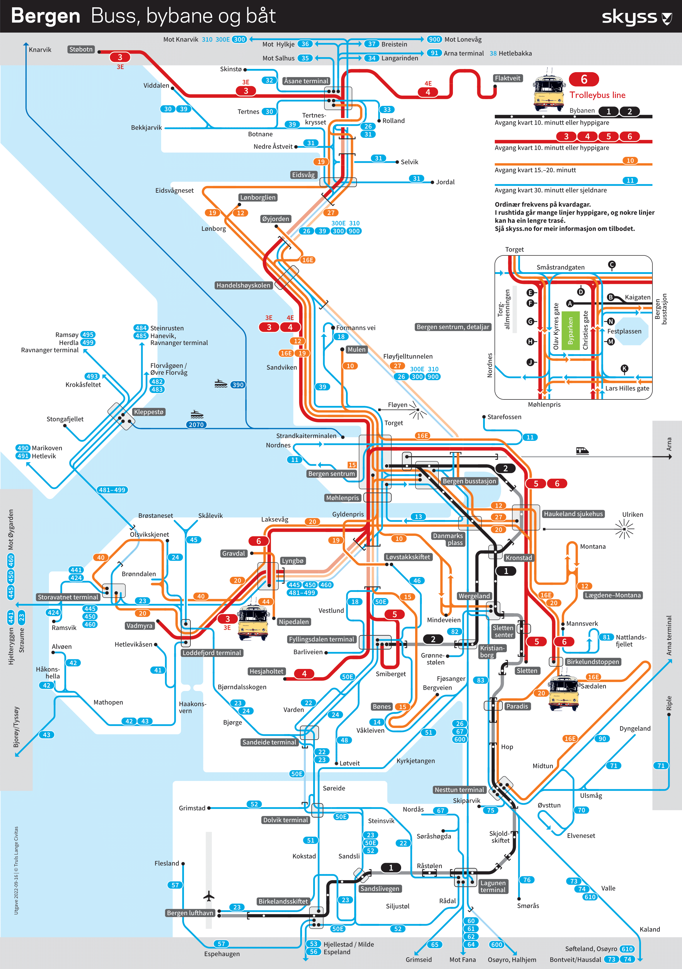
Orientační schéma MHD v Bergenu. Černou barvou jsou značeny trasy obou linek tramvajové rychlodráhy.
Linka 1 vede z centra města na Letiště Flesland, nová linka 2 z centra přes nemocnici Haukeland sjukehus do Fyllingsdalen.
Trolejbusová linka má číslo 6 a její konečné jsou na plánu značené symbolem trolejbusu ŠKODA 9Tr.
Platné k 21.11.2022 = ke dni zahájení provozu druhé linky tramvají a také dni návazných změn linkového vedení.

Orientation scheme of public transport in Bergen. Lines of Bergen light rail (fast tramway track) are marked by black colour.
Line No. 1 connects City Centre with Airport Flesland, new line No. 2 runs from Centre to Fyllingsdalen over Haukeland hospital.
Trolleybus line has No. 6 and its terminals are marked on map with symbol of ŠKODA 9Tr trolleybus.
Valid at 21.11.2022 = the date of the start of operation of the second tram line and also the date of subsequent changes to the bus line routes.

Zdroj/Source: Skyss

Hochgeladen von 9TrL194 · Pilsen           Datum: Montag, 21. November 2022

Statistik

Lizenz: Mark
Veröffentlicht: 19.10.2022 03:27 MSK
Aufrufe — 992

Detailinformation

Bewertungen

Kommentar

Bitte keine politischen Diskussionen, andernfalls wird Ihr Account für einen Monat gesperrt!
Zu Kommentieren ist eine Anmeldung nötig..