Transphoto
Fotos werden ohne Veränderungen publiziert, und sind nicht zur Werbung von politischer Ansichten oder Denkweisen bestimmt.

Alle Fotos werden durch Nutzern zur Verfügung gestellt, und sie darstellen keine Meinung der Seitenverwaltung.

Schließen
Toledo — Maps; Alliance — Maps; Wheeling — Maps; Canton, OH — Maps; Lancaster, OH — Maps; Mansfield — Maps; Pomeroy — Maps; Penn-Ohio System — Maps; Port Clinton — Maps; Portsmouth, OH — Maps; Fostoria — Maps; Conneaut — Maps; Eastern Ohio — Maps; Dayton — Maps and Plans; Cleveland — Maps and Plans; Cincinnati — Maps and Plans; Columbus, OH — Maps and Plans; Lake Shore Electric — Maps and Plans; Akron — Maps and Plans; Cleveland & Southwestern — Maps and Plans; Painesville — Maps and Plans; Ashtabula — Maps and Plans; Zanesville — Maps and Plans; Portsmouth, OH — Miscellaneous Photos
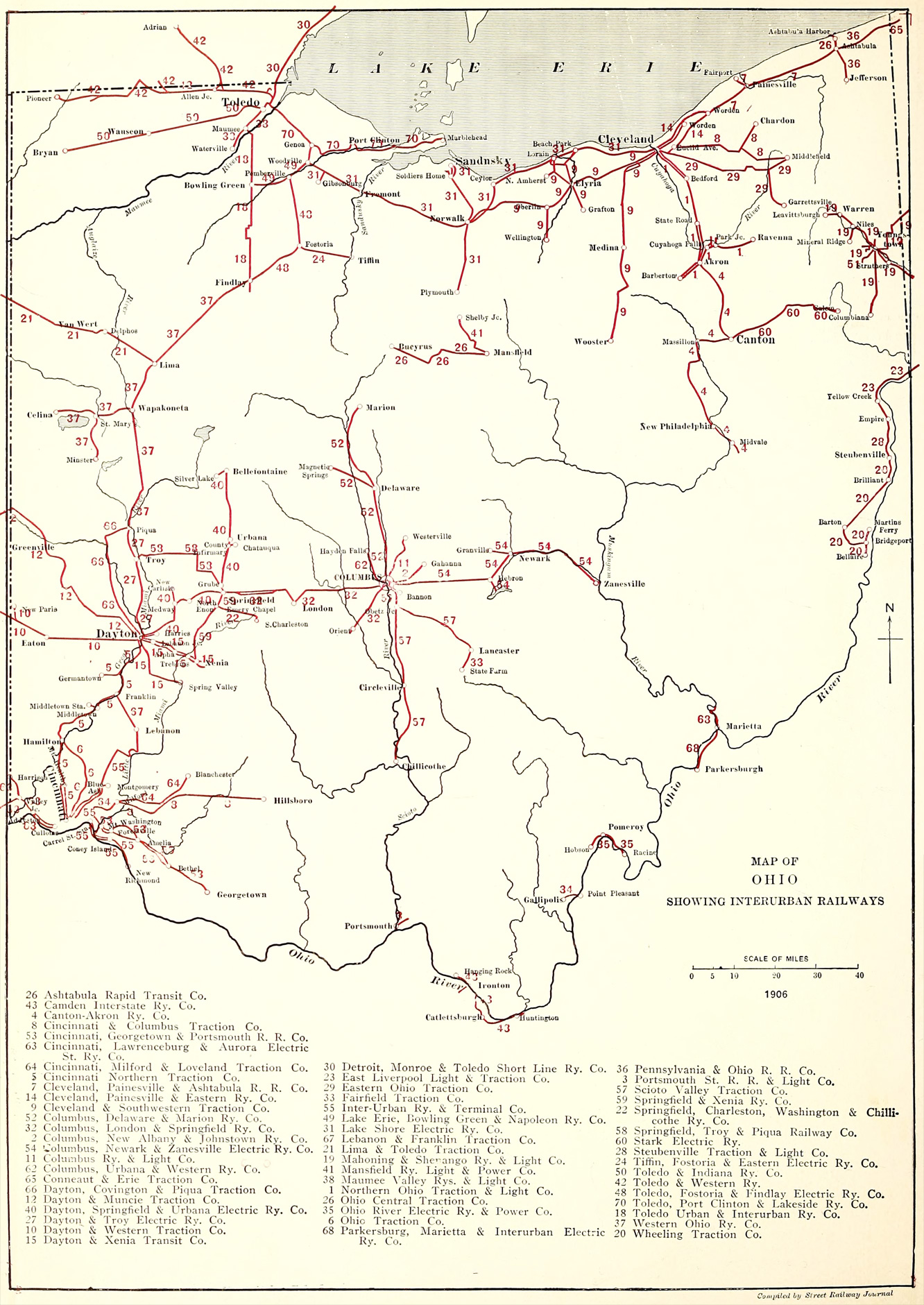
Map of Ohio, showing interurban railways
Compiled by The Arnold Company

Street Railway Journal, volume 28, number 15 (10/13/1906), plate XX

Hochgeladen von AlexSan · Odesa           Datum: . 1906

Statistik

Lizenz: Public domain
Veröffentlicht: 07.12.2020 00:36 MSK
Aufrufe — 804

Detailinformation

Kommentar

Bitte keine politischen Diskussionen, andernfalls wird Ihr Account für einen Monat gesperrt!
Zu Kommentieren ist eine Anmeldung nötig..